3D laser scanning is a powerful new technology that has many different applications across a range of different industries. One of the most common uses of laser scanning is in the field of architecture, where it can be used to create precise and accurate 3D models of large-scale buildings or construction sites. In addition, laser scanning can be used by manufacturers to quickly and easily create digital blueprints for new products, allowing them to produce products of higher quality with greater speed and efficiency. Finally, laser scanning is also commonly used by conservationists, who use this technology to analyze and preserve delicate historical artifacts and structures by creating high-resolution 3D images that can help prevent from damage or deterioration. Thus, it is clear that laser scanning has become an essential tool for many different fields due to its ability to capture data in three dimensions in an incredibly precise and efficient manner.
Can you 3D scan a building?
Yes, you can 3D scan a building using laser technology. This method uses laser scanning equipment to measure the dimensions and topography of a structure. Basically, a laser beam is projected onto the surface of the building, and the return time and intensity of light is used to calculate the distance between the laser and various points on the surface. This information can then be taken back to a computer for processing, which generates a detailed digital image of the building in 3D. Not only does this technique allow users to capture incredibly accurate representations of buildings with fine-grained details, but it also makes it possible to perform an analysis of these structures in order to identify potential structural weaknesses or other issues. So if you need to accurately measure a large building or perform an in-depth analysis of its structure, 3D laser scanning is undoubtedly one of your best options.
What is the difference between laser scanning and lidar?
Laser scanning and lidar are two related technologies that are used for analyzing a variety of different data sets. While laser scanning uses laser beams to measure distances and create high-resolution images, lidar uses laser beams to detect the height, velocity, and direction of nearby objects. Like laser scanning, lidar produces highly detailed data that can be used for mapping terrain or analyzing weather patterns. However, laser scanning and lidar also differ in several key ways. For example, laser scanners tend to have a shorter range than lidars, making them better suited for studying specific features of the landscape or measuring small-scale changes over time. Additionally, laser scanners typically produce lower-resolution images than lidars, meaning that they can only be used to analyze larger portions of the landscape at once. Ultimately, then, it is clear that laser scanning and lidar are both valuable tools for many different types of data analysis projects.
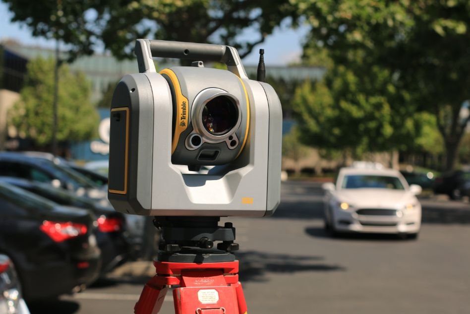
What is Laser scanning
Laser scanning, also known as laser ranging or laser triangulation, is a method of obtaining measurements by directing laser light at a target object. During laser scanning, laser beams are projected onto the object, and the reflected light is then collected using specialized sensors and analyzed to determine the properties of the object. This technique can be used to obtain highly detailed 3-dimensional representations of objects in a variety of fields, including engineering and medicine. Thanks to its precise and fast results, laser scanning has become an incredibly valuable tool for scientific research and practical applications alike. Whether you are studying the architecture of ancient cities or designing new medical devices, laser scanning offers a unique way to capture hard-to-reach details about any object. Click here is you want more info on what is lidar.
Does LiDAR work in the dark?
LiDAR is a technique that uses high-resolution lasers to accurately map and measure the landscape. LiDAR technology works well in most conditions, including bright sunlight and dense fog. However, it can also be used during nighttime hours for detailed mapping of structures and objects that are difficult to see during the day. LiDAR offers many practical benefits for those who need to operate within low-visibility conditions, such as first responders, search and rescue teams, wildlife researchers, and architects. Whether it is helping to identify potential hazards during a natural disaster or providing information on urban development projects, LiDAR makes it possible to work effectively in challenging environments. So while LiDAR may not be able to function perfectly in complete darkness, this powerful technology helps to open up new possibilities and overcome many obstacles that would otherwise be impossible to navigate.