Lidar, which stands for Light Detection and Ranging, is a remote sensing method that uses light in the form of a pulsed laser to measure ranges (variable distances) to the Earth. These light pulses—combined with other data recorded by the airborne system — generate precise, three-dimensional information about the shape of the Earth and its surface characteristics.
Do Surveyors Use LiDAR?
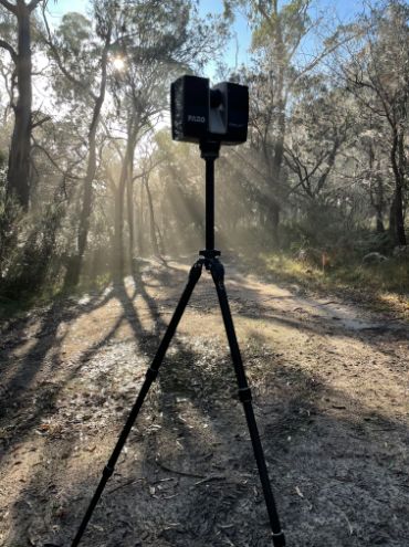
Yes, surveyors use LiDAR to inspect an area and create a three-dimensional model of the land. The technology is often used to assess environmental impact, map terrain, and study landforms.
This form of 3d laser scanning is used to produce highly accurate models.
How Does LiDAR Work?
LiDAR scanning works by shooting a laser beam at the ground and measuring the time it takes for the light to reflect back. This information is then used to create a detailed map of the area.
The benefits of using LiDAR include its accuracy, as well as its ability to scan large areas in a short amount of time. In addition, LiDAR can be used to gather data in difficult-to-reach places, such as dense forests.
If you have questions about what is 3d laser scanning used for then check out this post.
How Is LIDAR Captured?
A LiDAR instrument principally consists of a laser, a scanner, and a specialized GPS receiver. Airplanes and helicopters are the most commonly used platforms for acquiring lidar data over broad areas. Two types of lidar are topographic and bathymetric. Topographic lidar typically uses a near-infrared laser to map the land, while bathymetric lidar uses water-penetrating green light to also measure seafloor and riverbed elevations.
Surveyors use LiDAR data to create accurate maps and 3D models of an area. This information can be used for a variety of purposes, including environmental impact assessment, landform studies, and terrain mapping.
Need to know how much is a lidar survey? This article will cover all aspects of this and more.

What Are The Advantages of Using LiDAR for Surveying?
Using LiDAR as a surveyor has a number of advantages.
Accuracy
The most significant advantage is accuracy. LiDAR can provide data that is much more accurate than traditional surveying methods.
Speed
Another advantage of LiDAR is that it can cover large areas quickly. This is especially helpful when time is a factor, such as in emergency situations.
Versatility
LiDAR data can be captured terrestrially or from the air, depending on the project requirements. This flexibility makes LiDAR an ideal tool for surveyors.
Lidar is a powerful tool that can be used for mapping, surveying, and navigation. It has many applications in different industries, and its use is only limited by our imagination. If you’re interested in learning more about lidar or integrating it into your business, we’d be happy to chat with you and answer any questions you have. Contact us today to get started!